Traffic & mobility / Flagship demonstration

Know what is using the road. And how.

Automated vehicle counts, classification and speed monitoring for roads, junctions and car parks. Build evidence for transport planning, traffic calming and active travel without reading number plates.

Junction intelligenceEvery entry. Every exit.
Vehicles counted through a three-arm roundaboutTop-down view. Arms 1, 2 and 3 join from the west, east and south. Each vehicle is counted once as it crosses its entry line and once at its exit line; the totals are listed below.
Line counts
EntryExit
Arm 100
Arm 200
Arm 300
Turning movements
To 1To 2To 3Total
From 10000
From 20000
From 30000
Car
0
Utility
0
Bus
0
Bicycle
0

The measurement brief

Type. Direction. Time. Context.

See which vehicles use the road, when they pass and which routes they take through a junction.

Vehicle classification

Count cars, buses, motorcycles and bicycles. Delivery vans, HGVs, trucks and service vehicles use a unified utility class; pedestrian detection supports active travel studies.

Directional flow

Examine peak hours, historical patterns, junction turning movements and queue lengths. Combine current dashboards with repeatable reporting periods.

Calibrated speed zones

Measure speeds in a calibrated zone, set thresholds and review traffic-calming interventions. Optional speed-event snapshots provide evidence without continuous recording.

Field conditions

A model built for the view from above.

The traffic model is custom-trained for UK monitoring conditions, rather than relying only on eye-level photographs.

Elevated and oblique views

Perspective-matched training covers vehicle roof profiles, along-road views, side-on positions and oblique junction angles. Distant vehicles occupy a smaller part of the frame.

A consistent utility class

Vans, trucks and service vehicles are grouped consistently rather than relying on incompatible commercial-vehicle labels across datasets.

Partial visibility and tracking

Training addresses partly occluded vehicles at barriers and frame edges. Stable multi-object tracks help reduce duplicate detections and improve count continuity.

What we check at your site

  • LightingDaylight, dawn, dusk and street-lit night, including sodium and LED lighting.
  • WeatherRain, fog, mist, wet-road reflections, glare and backlight, as well as dry conditions.
  • Camera positionMounting height, viewing angle and distance, including typical lamppost positions 5-10 metres above urban and A-roads.
  • Traffic conditionsFree-flowing traffic, congestion and queues, with vehicles, cyclists and pedestrians sharing the view.

A site pilot checks performance in the conditions you expect. Lighting, weather, camera angle and vehicles hidden from view can all affect accuracy.

See the original work

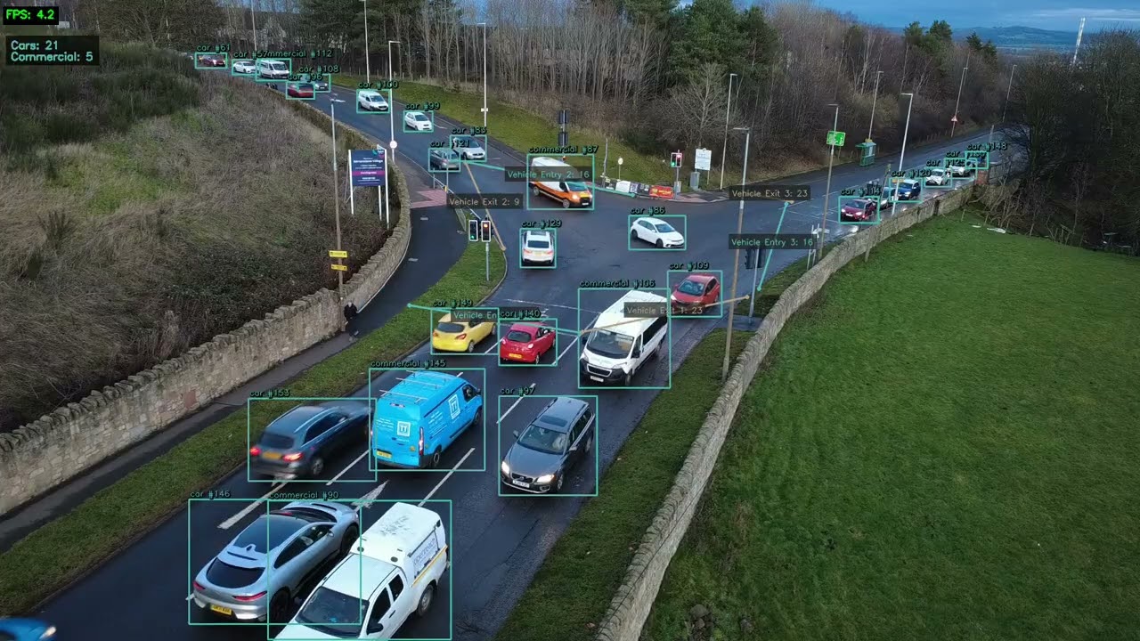
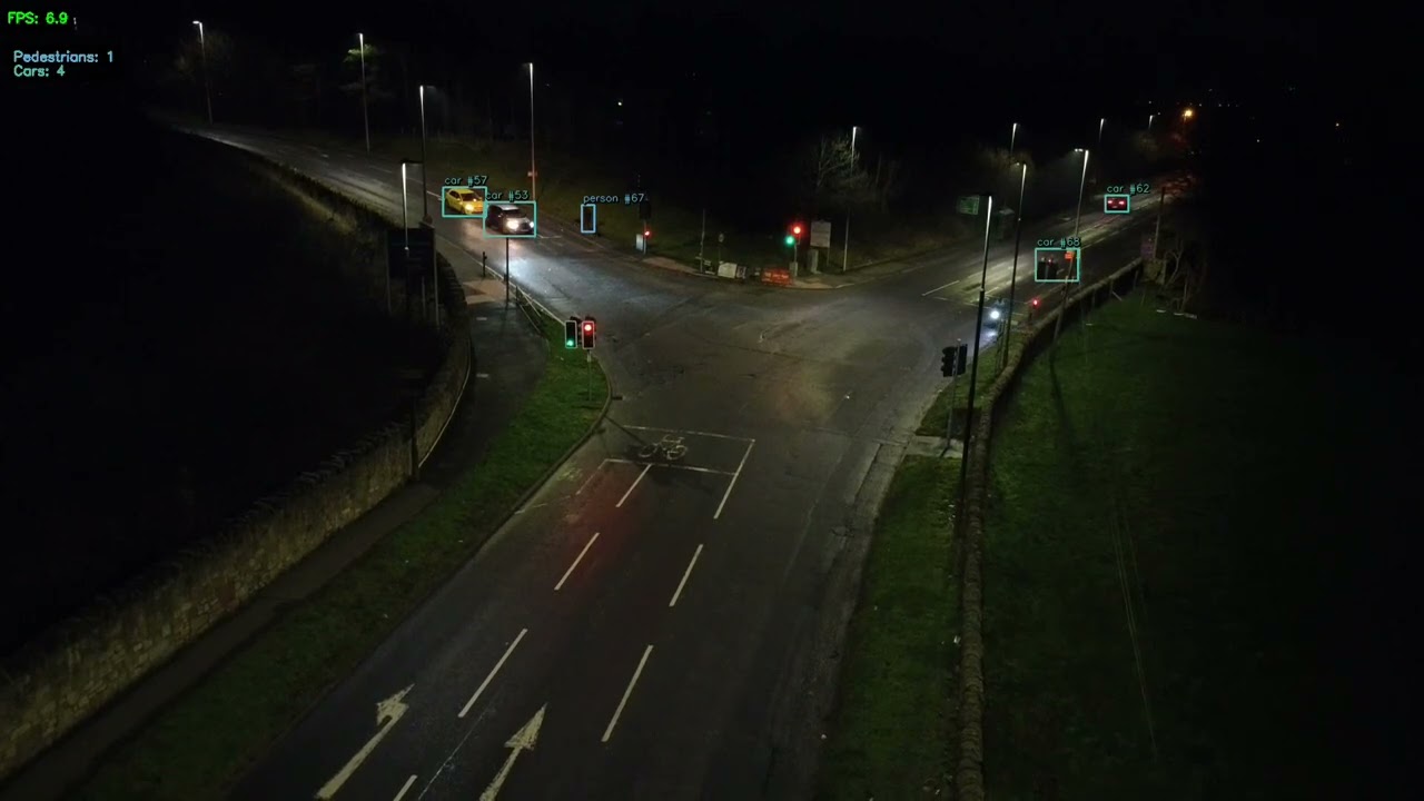
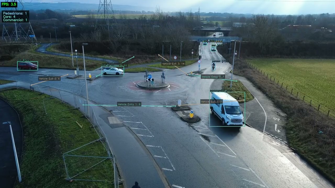
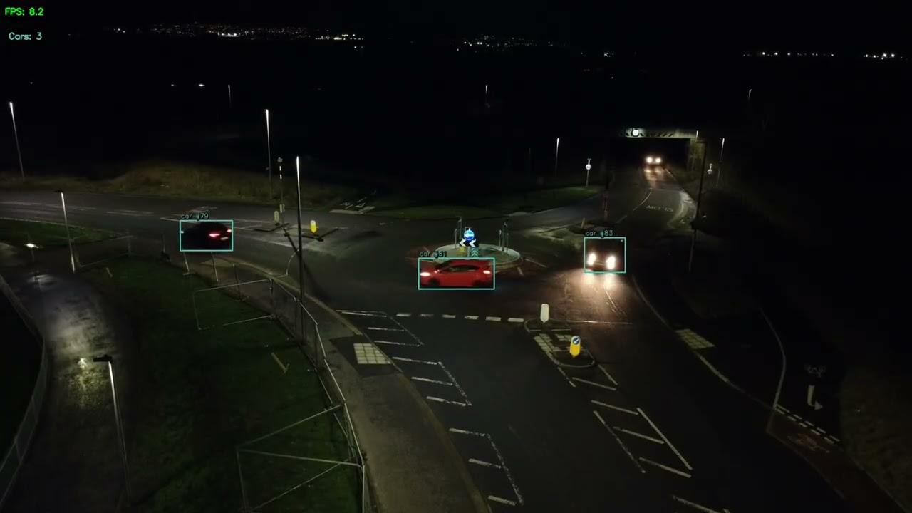
Edinburgh, in daylight and after dark.

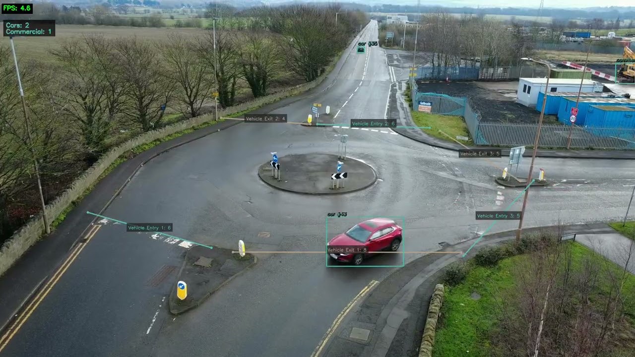
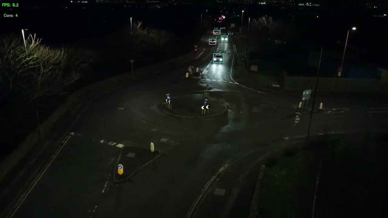
Six original demonstrations, filmed from a drone at lamppost height above each junction. These are demonstration recordings, not evidence of permanent installations at the locations.

Film 01 / Day

YouTube / off

Old Dalkeith Rd & The Wisp Intersection

Optional YouTube video. Loading sends your IP address to Google/YouTube and may let it use cookies or similar storage for measurement and advertising. You can withdraw in Media settings.
Film 02 / Night

YouTube / off

Old Dalkeith Rd & The Wisp Intersection (Night)

Optional YouTube video. Loading sends your IP address to Google/YouTube and may let it use cookies or similar storage for measurement and advertising. You can withdraw in Media settings.
Film 03 / Day

YouTube / off

Lasswade Rd Roundabout

Optional YouTube video. Loading sends your IP address to Google/YouTube and may let it use cookies or similar storage for measurement and advertising. You can withdraw in Media settings.
Film 04 / Night

YouTube / off

Lasswade Rd Roundabout (Night)

Optional YouTube video. Loading sends your IP address to Google/YouTube and may let it use cookies or similar storage for measurement and advertising. You can withdraw in Media settings.
Film 05 / Day

YouTube / off

Drum St/Gilmerton Road Roundabout

Optional YouTube video. Loading sends your IP address to Google/YouTube and may let it use cookies or similar storage for measurement and advertising. You can withdraw in Media settings.

Film 06 / Night

YouTube / off

Drum St/Gilmerton Road Roundabout (Night)

Optional YouTube video. Loading sends your IP address to Google/YouTube and may let it use cookies or similar storage for measurement and advertising. You can withdraw in Media settings.

Put the evidence to work

From a survey to a better road decision.

Use a common measurement approach across routine studies and changing road conditions.

Traffic surveys

Replace time-limited manual counting with automated monitoring by vehicle type, direction and time of day.

Traffic calming

Identify speeding hotspots, gather event evidence and compare the effect of interventions.

Junction analysis

Use turning movements and queue lengths to inform signal timing, capacity and safety reviews.

Car park monitoring

Review entry and exit counts, occupancy trends and turnover for capacity and pricing decisions.

Active travel

Count cyclists and pedestrians alongside vehicles to inform infrastructure investment.

Construction impact

Monitor roadworks, assess changing traffic patterns and plan diversions using observed data.

Changes that need attention

Define the exception, not just the average.

Traffic alert rules can flag unexpected inactivity, increased volume or speed events.

No activity

No vehicles detected at a monitored location for a configurable period.

No vehicles

Expected vehicle traffic has stopped; review possible road closures, access issues or monitoring conditions.

Volume threshold

Vehicle count exceeds a configured limit within a defined time window.

Speed violation

A vehicle exceeds the configured threshold in a calibrated speed zone.

Alerts are evaluated on a configured cadence and delivered near real-time. They are signals for review, not a guarantee of immediate detection. Models and rules can be configured per tenant, device and location; custom alert types can be scoped for your workflow.

Start with a conversation

Start with the road question.

Share the location, camera position and the decision your survey needs to support. We can scope a demonstration or site pilot.

Discuss your project
Direct to Percepta

Tell us about your site

Describe your site, your cameras and the question you need answered. We can discuss the right approach for your project.

  • Edinburgh, Scotland
  • UK & international enquiries

Send a secure enquiry

All fields marked * are required.

Please do not include passwords, payment-card details or sensitive personal information.

We use the details you provide to review and respond to your enquiry and protect the form from abuse. See our privacy notice.

Your choice

Optional video settings

These demonstration videos are hosted by Google/YouTube, separately from Percepta's on-device camera analytics. Loading a player sends your IP address to Google/YouTube and may let it use cookies or similar storage for measurement and advertising.

No YouTube player connects until you allow YouTube and explicitly load a video. Allowing here does not load any videos. Each player needs its own Load action, then Play; nothing starts automatically.

Your choice stays in memory while you browse these public pages and resets on a full page reload. We do not save a preference cookie or use browser storage.

Turning videos off immediately removes all loaded players. It cannot erase information YouTube has already received or cookies it has already set.

YouTube videos: off.